Saturday, March 14, 2020

Surrey Bend Regional Park

Park Sign
Another great park in Surrey, this one is maintained by MetroVanvouver.
We've been here before, in 2014. At that time, the park was very rough, with one very long trail to a swampy area, and pretty much just a Fraser River flood plain. Now the park has established trails, nature playground, interpretive trail signs, and almost 7 km of walking trails, as well as biking trails. There are also outhouses (fairly clean) and picnic areas
Map of Park
There are 3 separate trails: Spirea Loop (1.7 km), Pacific (3 km), and Parsons (3.2 km). We did the Spirea Trail. The trails are flat, wide, and fine gravel, very easy to walk on, and you could use a walker of wheelchair down the middle pretty easily. The surrounding flood plain is wide and clear of tall trees, so you get great views of the marshes, grass, and mountains in the distance. There are sections where the river is visible, and a couple of bridges over waterways that flow in and out of the park. We went in the winter, so there were no ducks or birds, aside from a lone hawk, but in the spring and summer, the trees, marches, and fields will be full of birds, squirrels, and butterflies ... and mosquitoes, I am sure!
Found It!
There are a few geocaches in the park, including a multi-cache (we solved it!).
This is a shared path park, so there might be bikes on the path with you. Dogs are allow ON A LEASH, and please pick up after your mutt 😀

MetroVancouver has a great website for the park, including a video, a photo gallery, some information about the park, and a Trail Guide/Map and Brochure.
Park and Playground


Saturday, February 8, 2020

Ka'ena Point, Oahu

I've looked at this park for a while, wanting to try it out one of the times we visit Aulani at Ko'olina. I've read a few warnings about mud puddles, long hot walks, and dangerous cliffs, but still I wanted to try it!
Welk, they weren't kidding about the mud puddles!
Even this guy was concerned! 
This is a 4X4 trail, or walking/biking. 
The park is at the very end of the Farrington Hwy, on the far West point of Oahu. You can. Also access the park from the north side, on a different trail, but since we were at Aulani, it made sense to go west.
The drive is not too long, maybe 30 mins if the traffic is "normal". The highway takes you through beach towns, with the pounding surf on your left, and miles of run down looking houses and businesses across from the beaches. Behind the town's, in the distance, are high mountains eroded by the rains that fall here in winter.
Just before you arrive at the trail head, there is a small lot with rest rooms, decently clean, and usable. Use them; you are in for a long walk!
But you don't have to walk that far. We went for 2 geocaches, and walked about 2 kms all together. That took us to some beautiful vistas of cliffs and pounding surf!
And if you are as lucky as I am, you might catch a glimpse of this multicolored beauty!
Even from the parking lot, the views are great.
Lush mountains and fields, breaking waves, and mud! Who could ask for more!

Friday, January 3, 2020

Jackman Wetlands Park - Aldergrove

Went for a geowalk on New Year's Day at Jackman Wetlands Park in Aldergrove.
The park is at the north west corner of 272nd St and 8th Ave; the entrance to the park is almost directly across from the Aldgrove Transfer Station (dump).
Bates Hotel, during filming (gone now)
The park is also the former film site for Bates Motel, which aired on cable from 2013 to 2017. The hotel and house is no longer there, but you can still see some of the old-looking structures. The structures are also features on the disc golf course, which some visitors have rated as the best in the valley. Not being a player myself, I could not say one way or the other, but I did witness some players slogging through and around mud holes to retreive theie frisbees!

The trails in the park are clean and maintained, very flat and compact. There were a couple of spots that you had to navigate through a puddle caused by minor flooding of ponds, but in general we kept clean and dry. It has been a little bit rainy the last few weeks, but in the summer it could be a lot drier. Also, while there are a lot of trees in the park, they are newer, smaller trees, and there are some spaces with no trees, so it could be warm in the summer.

There are a few geocaches in the park, some premium, some traditional, most pretty easy. There are a lot of people, so beware of muggles!

Dog owners will love the park, but please be mindful of others, and keep your dog on a leash, and clean up after your dog. Stepping in dog poop is gross! Also, they seem to train retreivers at the park, so a certain area might be off-limits, or at least watch for dogs running across the field, and know that there will be the crack gun shots - no one is trying to shoot you, I supposed they are blanks, considereing the populated area.

This is a great place for a walk, you can make it as long or as short as you want.

Tuesday, January 15, 2019

DeltaPort Container Tour


Part of being a tourist in your own back yard means going out and seeing things. Sometimes, while you are "touring", you see things and wonder "what is that?" or "what do they do there?". Even when you are driving to and from work, you see things that might interest you.
Google Map of Tilbury Area
 I worked for over a year in the Tilbury area of Delta, which is primarily a light to heavy industrial area, near the Fraser River. Every day, while driving to work, I would see large stacks of shipping containers, tug boats hauling barges, and trucks carrying shipping containers back and forth. I wondered, where are they going? What is in them? Why are there so many different kinds of containers?

According to the Port of Vancouver website, "the Port of Vancouver Delta Community Office provides an opportunity for the community to meet Vancouver Fraser Port Authority staff and learn about port operations, initiatives and projects, including the proposed Roberts Bank Terminal 2 Project." They are open to the public, and they offer free information and speaker sessions, bus tours, and provide additional information regarding 
Fraser River in Tilbury
the impact of the port and its future developments. You can subscribe to their newsletter here.
It took a couple of attempts, but I was finally able to score a couple of free tickets to the Container Trail Tour. The tour sells out quickly, but if you are patient, it is worth it.
Stacks of Containers
We arrived at the office Saturday morning for the 9AM tour. After donning a safety vest and grabbing a couple of cookies (and a quick stop at the washroom!), we were loaded onto a small tour bus and took off. for Tilbury Industrial Park. You see the various container storage areas, the large LNG storage facility, truck staging areas, and if you are lucky, you might catch a glimpse of a Seaspan tug boat hauling a large barge down the river.

Next it is off to the DeltaPort at Roberts Bank. We drove through a couple of industrial complexes getting there, including the new Canada Customs container inspection facility and the new Amazon facility. From there we went to the actual port, which is not usually accessible to the public. Lucky for us, one of the guides had a back stage pass!

Driving among the huge cranes and gantries, seeing massive ships being loaded and unloaded, makes you realize how important this port is to our economy. It is also good to know that the Port takes into consideration the communities it affects, including Tsawwassen First Nations.

The tour is very informative, and it is good to interact with the guides and the other guests, especially if you or someone else has experience in the shipping and logistics industry. On our tour, we had a Longshoreman that had experience operating one of the huge cranes, and was also quite knowledgeable on the various operations around the port.
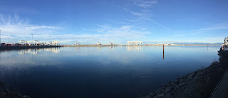
Looking North from Tug Basin
The tour takes 2 hours, and will run rain or shine. there is no walking, except to and from the bus, and at one point you get out for a quick break and some fresh air at the end of the main port dock, near the tugboat dock. This is a great chance to take some pictures of the surrounding mountains and shores, and the area on the other side of the port. As this is a working port, we were not allowed to take pictures of the ship being unloaded, but it was great to watch the remote-controlled cranes doing the work.

For me, this was the first of more tours like this.
Look like Walkers from Star Wars!

There are Bald Eagles EVERYWHERE!

Monday, February 12, 2018

North Delta Greenway

Saw this Cyber Rock ... interesting
Shared use bike/walking paths are great. They offer us the opportunity to take long walks on a generally level, easy to navigate, surface. The Surrey/North Delta are is full of bike and walking paths, including many going through the various watershed areas, but for a nice easy walk, look for the ones that are along a dike or railway track.

The North Delta Greenway Path runs from Planet Ice just off Nordel Way, to as far south as Cougar Creek, on Westview Drive, just off 72nd Ave. Right across the tracks to the west from the greenway trail is the Delta-South Surrey Regional Greenway, which runs all the way to almost the far west end of Colebrook Road, at the BNSF tracks near Hwy 99. There are a few places to safely cross the railway tracks between the two trails, but it is safer to pick one side and stay on it. Along with the private property of the tracks, there is also a creek that needs to be crossed, which can be very full during the rainier days (of which we get a few!)

Speaking of rain, even with the wet weather we've had the last couple of months, the walkway is pretty decent, with only a few mud holes and puddles to traverse, so rubber boots are certainly not necessary. The trail is up the hill from the railway track level, and well away from the bog. The only real water issue comes from the drainage from the upper streets and properties, so the occasional
mini-creek could run through the trail.

The scenery is great, with the creek running through, the occasional Amtrack zipping by, and the trees are full of birds. The banks are not too overgrown with thorns and brush, so getting the geocaches along the trail is fairly easy. Not much bushwacking is requires, although a quick scamper up the bank might be!

This walk can be rated as easy to moderate, and depending on how much energy you have, can be either a short or long walk. Remember to share the road, as it is a multi-use bike/walking trail. The walkway is wheelchair/walker friendly for the most part, but you might have to clean your wheels off before putting the chair back in the car!

For more information on North Delta trails, visit This website.

Monday, October 23, 2017

Whatcom Falls Park

We were in Bellingham, Washington this weekend for a concert, and wanted to go early to do some ... yup, you guessed it! Geocaching! So we thought we would check out Whatcom Falls Park!

Stefani with one of the geocaches we found
According to the Washington Trail Association website, there are three and a half miles of trails in the park, with loops and trails leading along cliff and ravines, through open meadows, and seemingly huge forests. The parking area is off Electric Ave, just off Lakeway Dr, in south east Bellingham, not far from the I-5. We took the Silver Beach Rd entrance, and drove straight into the parking lot near the end of the road, where there is a park, washrooms, picnic tables, and the beginning of a few trails. Continuing farther down the road would lead you to the hatchery.

1939 Stone Bridge
The falls
A short easy walk down the trail from the parking lot brings you to a stone bridge; actually Chuckanut sandstone, built in 1939 as a Roosevelt Works Progress Administration project, according to Kulshan.com. From there you can go to the right, to the upper falls and Whatcom Creek's higher level, or left, to the loops trails, and off-leash dog area.

Great Photo Ops!
The trails are numerous, and many different types. Where we went, the elevations were okay, not too steep or long. The trails themselves are well-used, for the most part, and even with all the rain we've been having, our footing was stable. Actually, I don't think I slipped once, and I am a klutz! Through the trees, the trails are mostly narrow and rocky, with some close to the edge of the ravine, or just up from the edge, with some good viewpoint pull-outs. There are many photo opportunities of the falls, bridges, and creek. We didn't see a lot of wild life, but there was evidence of woodpecker or flicker activity, and a lot of berry bushes to feed on. I would say that with the off-leash dog area nearby, and a lot of dog walkers in the park, coyotes and rabbit would likely make themselves scarce. Being later in the season, squirrels and such would also be scarce.
1939 Stone Bridge

In 1999, a major fuel leak caused a massive explosion and fire in the park, killing three people, and destroying a large part of the park. Almost twenty years later, some of the park is still closed for rehabilitation. The pipeline runs right through the park, even crossing over the creek in one part. The open access are that the pipeline runs through makes up a large part of the walking and off-leash area.

This park is worth exploring more than once, and I think we'll be back for more!

PDF Map of the park

Wikipedia of Whatcom Falls Park


Monday, September 25, 2017

Green Timbers Lake

Green Timbers Urban forest is, according to the City of Surrey website, one of the city's largest parks, with over 10 km of trails. It also contains a small lake, regularly stocked with Rainbow trout. There is a nature centre nearby, which is a great place to take the kids, big or small, to learn about the nature at the park. The park is located, literally, in the city, on 100th Ave, between 140th and 148th St.

I went to the park to try fishing, and while it was not a good day for catching, the fishing was good. nice weather, fairly quiet, and no snags!


Just walking around the lake provided a bit of exercise, something that  should do more often. If you want to walk more, there are trails that go in every direction. The trails are well-marked, and there are maps and signs posted. Getting lost isn't really a problem, since walking in any direction will take you to a city street. Also, the cell reception is excellent, so keep an eye on the GPS if you are worried. Speaking of GPS, there are no geocaches in the park, although there are a couple on the edge.

I bought some special bait, at the advise of my well-versed neighbour, so I will be back, hopefully landing the monster!